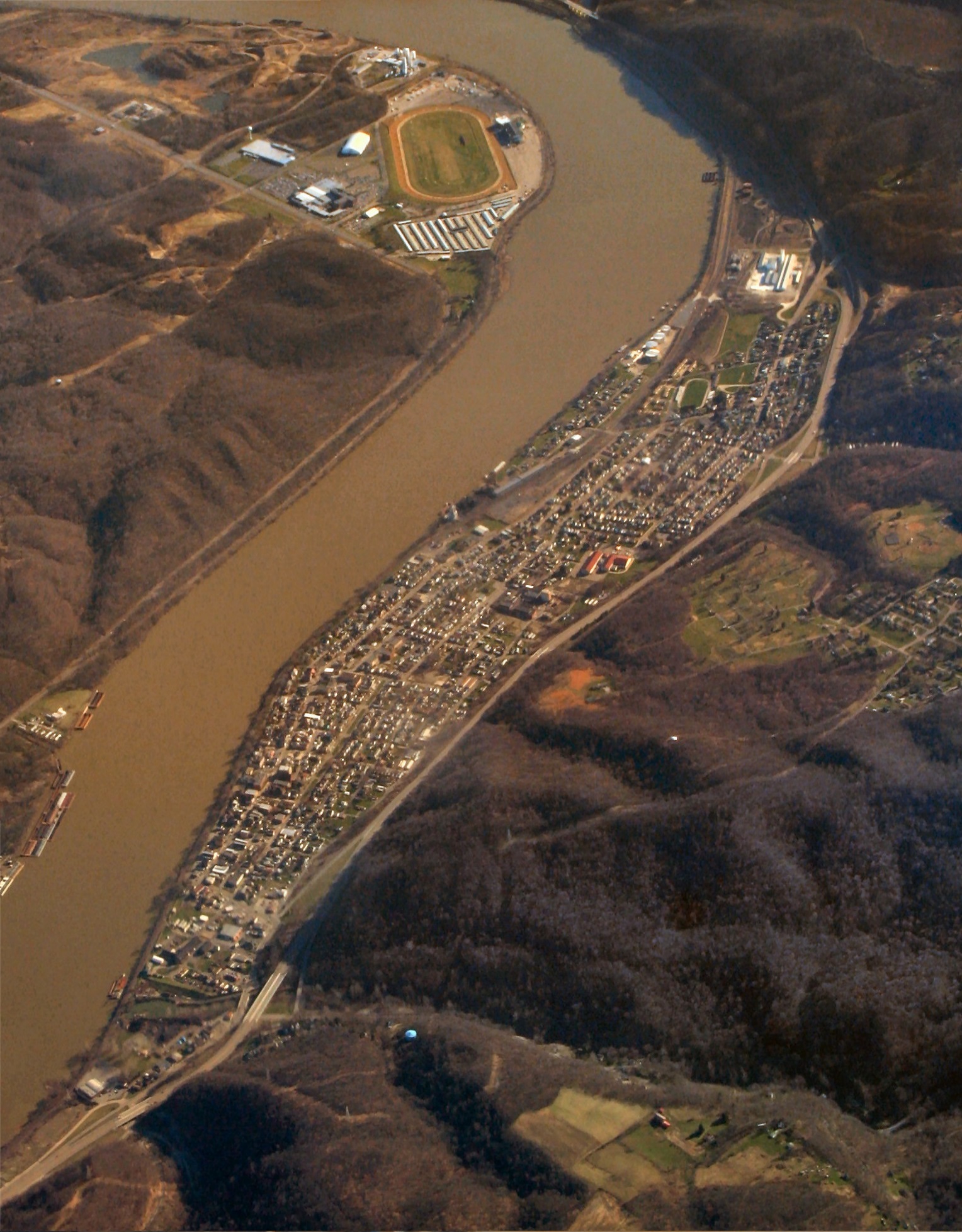
Wellsville, Ohio is a village in Columbiana County, Ohio, United States, along the Ohio River.
It is in Yellow Creek Township, Columbiana County, Ohio.
Wellsville was founded about 1795 and grew in the 19th and early 20th centuries. In 1838 the population was 759. By 1900 the U.S. Census showed the population at 6,146. In 1920 the city peaked at 8,849 according to the Census. Since then, each census shows the population declining.[4]:6, 60
The population was 3,541 at the 2010 census.[5]
In 1770, George Washington with his friend and personal surveyor, William Crawford (soldier), embarked on a journey down the Ohio River from Pittsburgh for the purpose of viewing lands to be apportioned among soldiers who had served in the French and Indian War. They are reported to have surveyed the Wellsville area (just north of the Yellow Creek[6]) in 1770 and noted in his journal that it was good bottom land.
The Yellow Creek Massacre occurred near Wellsville in 1774. A group of Virginian settlers killed the relatives of a prominent Indian leader, Logan, who was camped on Yellow Creek. Logan took revenge, resulting in Lord Dunmore's War.
James Clark and William Wells first settled in the area in 1795. Although they had to leave for a while due to Indian attacks in the area, they returned between 1797 and 1800. Wellsville was founded in 1797 by William Wells, a Pennsylvanian, and former justice of the Territory Northwest of the River Ohio.[7] Wellsville's first school and church were also established before 1800. A barn built in 1807 by the Aten family was moved to Hale Farm and Village in Bath, Ohio.[8]
In the 1820s the first Methodist Episcopal Church was organized by Rev. John Callahan in the house of William Wells. This is supposed to be the first Methodist Episcopal Church organized in the State of Ohio. Shortly thereafter, Well's son, Joseph Wells, founded the Wellsville's Central Methodist Church.
In 1814 a turnpike road was built to Lisbon, Ohio and in 1816 a post office was
established at Wellsville with John J. Feehan serving as postmaster.
The town of Wellsville finally took shape around 1823 when William Wells recorded that lots had been laid out for planned settlement. The initial site was bounded by the current Third and Fifth Streets, between Riverside Avenue and Commerce Street (although at the time they had different names.)[4]:4–6
In 1836, a foundry was opened at Wellsville to make steamboat machinery. It later became known as the Stevenson Company and produced brick-making machinery. Now it is a Fabrication and Machine Shop whose major function is building all types of Processing Equipment for the Ceramic, Porcelain Enamel (Frit Grinding), Paint, and Chemical Manufacturing Industries.
Wellsville was incorporated as a village in 1848.[9]
In 1852 the Cleveland & Pittsburgh Railroad (later acquired by the Pennsylvania Railroad) built a track from Hanover, Ohio to Wellsville and in 1856 it built a track from Wellsville to Rochester, Pennsylvania.
On February 14, 1861 Abraham Lincoln, on his way to his first inauguration, spoke to a large gathering in front of the Whitakre House, a hotel, in Wellsville.
On July 26, 1863 the Confederate Stares ArmyGeneral officerJohn Hunt Morgan and several hundred of his soldiers surrendered to pursuing Union forces and were held in Wellsville before being shipped to the Ohio Penitentiary at Columbus, Ohio. Gen. Morgan was put up at the Whitaker House, a hotel in Wellsville. The men were treated more like criminals than prisoners of war at the Ohio Penitentiary. Morgan's raid was the northernmost advance of Confederate troops during the Civil War.
At this time Ohio State Route 45 (on the eastern border of Wellsville) was known as the Warren-Ashtabula Turnpike which ran from Wellsville, Ohio, to Ashtabula, Ohio. It was an important part of the Underground Railroad.
During the 1896 presidential campaign Democratic candidate William Jennings Bryan addressed a crowd in Wellsville, Ohio from the back of a train. Bryan was the first candidate to successfully embrace "whistle stop" campaigning, harnessing the power of a young rail network to reach masses of voters.
In 1951, his only year of varsity basketball at Wellsville, Clarence Bevo Francis scored 776 points in 25 games for an average of nearly 32 point per game. In the process, he led his team to a stunning 19-1 regular season record and a berth in the state playoffs. He was a unanimous all-state performer.
Areas of Interest[]
Spring Hill Cemetery. Established in 1856. Approximately 73 acres in size.
PFC Melvin Earl Newlin Memorial. PC Newlin was awarded the Congressional Medal of Honor.
St. Elizabeth Cemetery.
Hammond Park.
Bottle Kiln:
Wellsville Ohio Bottle Kiln
This Bottle Kiln is located at the corner of 3rd Street and Lisbon Street in Wellsville, Ohio. The kiln is 41.5 feet high. The Kiln is maintained by the Wellsville Historical Society, P.O. Box 13, Wellsville, OH 43968.
The Boy and the Boot statue.
Fulton & Sons Bell: Located at the Free & Accepted Masons of Ohio Lodge on Main Street
The oldest bell in Wellsville, Ohio. Forged by Fulton & Sons of Pittsburgh, Pa. At the time in was cast it was the largest bell in America. Cast in 1871 it is 44 inches in diameter. Fulton bells are unique because of the crown that suspends it. All Fulton bells have this crown making the identification easy.
Flood Wall with Murals.
Honor Roll Wall Located at the intersection of Wells Avenue and State Route 45. This Honor Roll Wall pays tribute to every Wellsville resident who, living or dead, served their country in the armed forces. At present there are more than 2,200 names on the wall. The construction was directed by the Wellsville Veterans Memorial Council and done by the George Crews Construction Company.
It is located on the Allegheny Plateau. Its southern border is the Ohio River. On its eastern border is the Little Yellow Creek and on its western border is the Yellow Cheek. Its northern border is rising hills.
According to the United States Census Bureau, the village has a total area of 1.91 square miles (4.95 km2), of which 1.80 square miles (4.66 km2) is land and 0.11 square miles (0.28 km2) is water.[1]
Demographics[]
2010 census[]
As of the census[2] of 2010, there were 3,541 people, 1,475 households, and 957 families residing in the village. The population density was 1,967.2 inhabitants per square mile (759.5 /km2). There were 1,774 housing units at an average density of 985.6 per square mile (380.5 /km2). The racial makeup of the village was 89.3% White, 6.8% African American, 0.1% Native American, 0.4% Asian, 0.5% from other races, and 3.0% from two or more races. Hispanic or Latino of any race were 1.2% of the population.
There were 1,475 households of which 34.6% had children under the age of 18 living with them, 36.0% were married couples living together, 22.5% had a female householder with no husband present, 6.4% had a male householder with no wife present, and 35.1% were non-families. 30.8% of all households were made up of individuals and 12.6% had someone living alone who was 65 years of age or older. The average household size was 2.40 and the average family size was 2.96.
The median age in the village was 37.6 years. 26% of residents were under the age of 18; 8.3% were between the ages of 18 and 24; 24.3% were from 25 to 44; 26.5% were from 45 to 64; and 14.8% were 65 years of age or older. The gender makeup of the village was 46.9% male and 53.1% female.
2000 census[]
As of the census[11] of 2000, there were 4,133 people, 1,696 households, and 1,107 families residing in the village. The population density was 2,348.4 people per square mile (906.7/km²). There were 1,869 housing units at an average density of 1,062.0 per square mile (410.0/km²). The racial makeup of the village was 90.59% White, 6.97% African American, 0.12% Native American, 0.12% Asian, 0.02% Pacific Islander, 0.05% from other races, and 2.13% from two or more races. Hispanic or Latino of any race were 0.39% of the population.
There were 1,696 households out of which 31.4% had children under the age of 18 living with them, 42.0% were married couples living together, 19.0% had a female householder with no husband present, and 34.7% were non-families. 30.2% of all households were made up of individuals and 15.6% had someone living alone who was 65 years of age or older. The average household size was 2.43 and the average family size was 3.02.
In the village the population was spread out with 26.3% under the age of 18, 9.5% from 18 to 24, 26.9% from 25 to 44, 21.4% from 45 to 64, and 16.0% who were 65 years of age or older. The median age was 37 years. For every 100 females there were 86.9 males. For every 100 females age 18 and over, there were 80.8 males.
The median income for a household in the village was $26,198, and the median income for a family was $33,245. Males had a median income of $26,724 versus $19,904 for females. The per capita income for the village was $14,335. About 16.5% of families and 17.1% of the population were below the poverty line, including 23.3% of those under age 18 and 12.1% of those age 65 or over.
Education[]
Wellsville is served by the Wellsville High School (Ohio). It is in the Wellsville Local school district. [3]
Wellsville is also served by the Wellsville Carnegie Public Library. It was established on Feb. 15, 1912 In 2005, the library loaned more than 55,000 items to its 8,000 cardholders. Total holdings as of 2005 are over 36,000 volumes with over 62 periodical subscriptions.[12]
Notable people[]
William Burr McIntosh - A lecturer, photographer, movie studio owner, silent film actor, author, publisher of Burr McIntosh Monthly.
Melvin E. Newlin - United States Marine and Medal of Honor recipient.
^From Hale Farm's website: Though Wheatfield Village never really existed, the historic buildings are original 19th century structures built within Ohio's Western Reserve. These buildings were acquired by Hale Farm and moved to the site as part of a "historic preservation through relocation" program. http://wneo.org/halefarm/village/wheatfield2.htm
History of Wellsville, OH by Frank L. Wells From: History of Columbiana County, Ohio by Harold B. Barth The Historical Publishing Company Topeka-Indianapolis, 1926
Before The Memory Fades 1795 - 1950 by Edgar Stanton Davidson Hardcover, 72 pages Publisher: The Wellsville Historical Society:1003 Riverside Avenue, Wellsville, OH(330) 532-1018
Butler | Center | Elkrun | Fairfield | Franklin | Hanover | Knox | Liverpool | Madison | Middleton | Perry | Salem | St. Clair | Unity | Washington | Wayne | West | Yellow Creek
Census-designated places
Calcutta | Glenmoor | La Croft
Other localities
East Rochester | Elkton | Homeworth | Kensington | Negley | North Georgetown | West Point | Winona
This page uses content from the English language Wikipedia. The original content was at Wellsville, Ohio. The list of authors can be seen in the page history. As with this Familypedia wiki, the content of Wikipedia is available under the Creative Commons License.


