| Main | Births etc |
|---|
| Town of Danville | |
|---|---|
| — Town — | |
 |
|
 |
|
| Coordinates: Coordinates: | |
| Country | |
| State | |
| County | Contra Costa |
| Government | |
| • Mayor | Karen Stepper[1] |
| • Senate | Mark DeSaulnier (D) |
| • Assembly | Joan Buchanan (D) |
| • U. S. Congress | Jerry McNerney (D) |
| Area[2] | |
| • Total | 18.028 sq mi (46.693 km2) |
| • Land | 18.028 sq mi (46.693 km2) |
| • Water | 0 sq mi (0 km2) 0% |
| Elevation | 358 ft (109 m) |
| Population (2010) | |
| • Total | 42,039 |
| • Density | 2,300/sq mi (900/km2) |
| Time zone | PST (UTC-8) |
| • Summer (DST) | PDT (UTC-7) |
| ZIP codes | 94506, 94526 |
| Area code(s) | 925 |
| FIPS code | 06-17988 |
| GNIS feature ID | 0277497 |
| Website | danville.ca.gov |
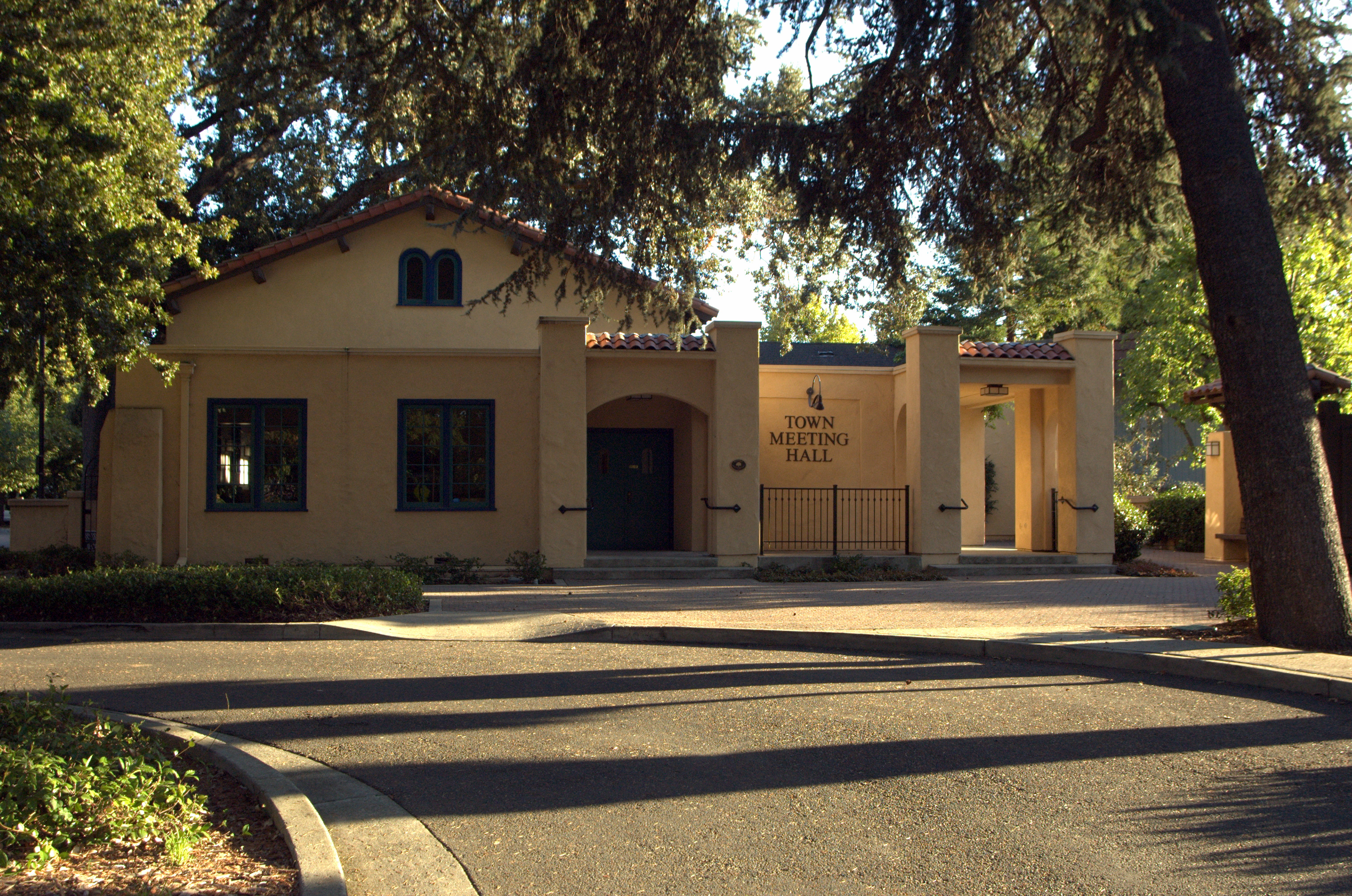

Town Meeting Hall
The Town of Danville[3] is located in the San Ramon Valley in Contra Costa County, California. It is one of the incorporated municipalities in California that uses "town" in its name instead of "city". The population was 42,039 in 2010. Danville is one of the wealthiest suburbs of Oakland and San Francisco. It is home to some of the most expensive real estate and exclusive country clubs in the nation. According to Businessweek, Danville is the 41st most expensive zip code in America. [4]
Danville hosts a farmer's market each Saturday next to the San Ramon Valley Museum.[5]
The Iron Horse Regional Trail runs through Danville. It was first a railroad that is now converted to a 80-foot (24 m) wide corridor of bike and hike trails as well as controlled intersections. Extending from Dublin to Concord, the trail passes through Danville. Walkers, bikers, skaters, and joggers usually find the Trail a source of outdoor recreation and exercise. Furthermore, the Trail is relatively isolated from the heavy traffic on the main roads, so it is a relatively safe path to travel on. The trail is also close to all the major bookstores, shops, cafes, and restaurants in Danville, so those who are doing a long trip often stop in Danville to eat or drink.
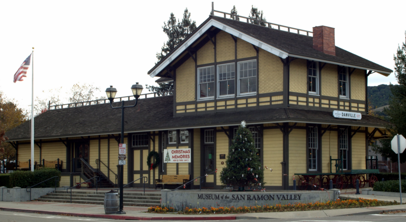
The Danville Library hosts a number of community events, such as the annual Halloween activities for kids and book sales. The Museum of the San Ramon Valley is located in downtown Danville and hosts regional history exhibits and traveling shows in the converted railroad station adjacent to the Iron Horse Trail.
Danville is home to two main public high schools: Monte Vista High School and San Ramon Valley High School, which share a longstanding cross-town rivalry. There is a continuation high school called Del Amigo, which is stationed next to San Ramon Valley High. It is also home to The Athenian School, a private college preparatory school for grades 6-12 that is nestled in the foothills of Mount Diablo State Park. Danville's public schools are rated some of the best in California, with 98% of its high school graduates attending colleges and technical schools.
Danville is also home to the Village Theatre and Art Gallery, hosting children's theatre, Broadway shows and art discussions.[6]
History[]
For over 130 years, Danville's history has been one of change and growth.[7] Often referred to as the "Heart of the San Ramon Valley," Danville was first populated by Native Americans who lived next to the creeks and camped on Mount Diablo in the summer. Later it was part of Mission San Jose's grazing land and a Mexican land grant called Rancho San Ramon.
Danville is named, in part, after Daniel Inman, who bought 10,000 acres (40 km2) there in 1854 with his brother Andrew, using their Gold Rush earnings. They rejected the name "Inmanville" and settled on Danville. However, "According to the modest Dan, the name was chosen as much or more out of respect for Andrew's mother-in-law, who was born and raised near Danville, Ky.," says one historical account. Initially a farming community, the Town of Danville switched from wheat to fruits and nuts after the Southern Pacific Railroad built a spur line through the area in 1891. It developed as a residential suburb starting in 1947 when the first sizable housing tracts were constructed and its population boomed in the 1970s and 1980s.[8]
The Danville Post Office opened in 1860 with hotel owner Henry W. Harris as the first postmaster.[9] Harris reported in 1862 that there were 20 people living in the town proper, with 200 ballots cast in the last general election. Hearing stories of the prosperity to be found in California, people from the mid-west and east began to settle in Danville and the surrounding valleys. Most new residents had been farmers and observed that the valley land was fertile and the weather benign, altogether an ideal place to settle. The 1869 census counted nearly 1800 people in the combined Danville and Lafayette areas. They squatted or purchased land from the Mexican and other owners and established ranches, farms and businesses.
Settlers raised cattle and sheep and grew wheat, barley and onions. Later the farms produced hay, a wide variety of fruit crops (apples, plums, pears), walnuts and almonds. In the 1800's horses and wagons hauled these products north to the docks at Pacheco and Martinez, following Road No. 2, which wound by San Ramon Creek and was almost impassable in the rainy season.
Churches, schools, farmers unions and fraternal lodges began as the community evolved. The Union Academy, a private high school begun by the Cumberland Presbyterian Church, served the County from 1859 to 1868 when it burned down. The Danville Presbyterian Church was dedicated in 1875, following a vote of Protestants regarding what denomination it should be. The new building was described as the handsomest church building in the County by the writers of the day.
In 1873, Danville Grange No. 85 was chartered with Charles Wood elected as the first Worthy Master. The Grange began as a family farmers union and included all the Valley "movers and shakers." It served as the focal point for community social, educational and political activity for years and still meets at its Hall on Diablo Road.
A remarkable number of early Danville buildings remain today such as the houses belonging to the Boone, Osborn, Young, Spilker, Podva, Vecki, Root, Elliott and Hartz families. The Danville Hotel and original 1874 Grange Hall exist as well. Many of the early pioneer names appear on the streets and schools, including Baldwin, Harlan, Wood, Love, Hemme, Boone, Bettencourt and Meese.
When the Southern Pacific Railroad came to the Valley in 1891, Danville changed dramatically. The farmers built warehouses and shipped crops by rail in any kind of weather, and the residents traveled to and from Danville with an ease they had not experienced before.
John Hartz sold 8.65 acres of his land for the Danville station and granted land access to the depot. He then subdivided and sold lots east of the station, shifting the town's focus from Front Street to Hartz Avenue. Eventually, a bank, drug store, saloon, doctor's office and Chinese laundry joined the houses lining the street. The Danville Hotel originally sat across from the station and was moved to face Hartz avenue in 1927.[10]
The twentieth century found Danville affected by the wars, the Spanish flu, the depression and new immigrants. The Valley became a melting pot of Chinese, Portuguese, German, and Japanese immigrants. They often began working in the hay fields or as cooks and gardeners, later becoming blacksmiths, landowners, teachers and storekeepers.
Residents worked diligently to improve their community. In 1910 a public high school district was organized and San Ramon Valley Union High School was built; a library supervised by Lillian Close opened in 1913 with 104 books; St. Isidore's Catholic Church was first established at Hartz and Linda Mesa in 1910; and an Improvement League spearheaded the first streetlights and paved roads in 1915.
Danville continued to be farm country well into the 1940's. The whole Valley had 2,120 people in 1940, growing to 4,630 by 1950. Developments such as Montair and Cameo Acres were built, the water and sewer districts extended their boundaries, and the new I-680 freeway which sliced through Danville in the mid-1960's altered Danville permanently.
The Valley population leaped from 12,700 in 1960 to 15,900 in 1970, to 21,100 in 1975 to 26,500 in 1980. The 1980 census showed that 82 percent of Danville's 26,500 had arrived after 1970. In 2000, Danville’s population was 40,484. The days when everybody knew everybody else were long gone.
But in 1982, Danville citizens showed their strong sense of identity by voting to incorporate their community, allowing themselves to shape future changes more directly.
After 130 years, the small settlement on the banks of the Creek has grown from a blacksmith shop to a thriving community - still changing, still beautiful and still special.
Geography[]
Adjoining towns and cities are San Ramon to the south, Diablo, and Alamo to the north. Walnut Creek is 9 miles (14 km) north, while Pleasanton is about 12 miles (19 km) south.
Interstate 680 serves as the main means of transport out of the town.
According to the United States Census Bureau, the town has a total area of 18.0 square miles (47 km2). All of it is land and none of it is covered by water.
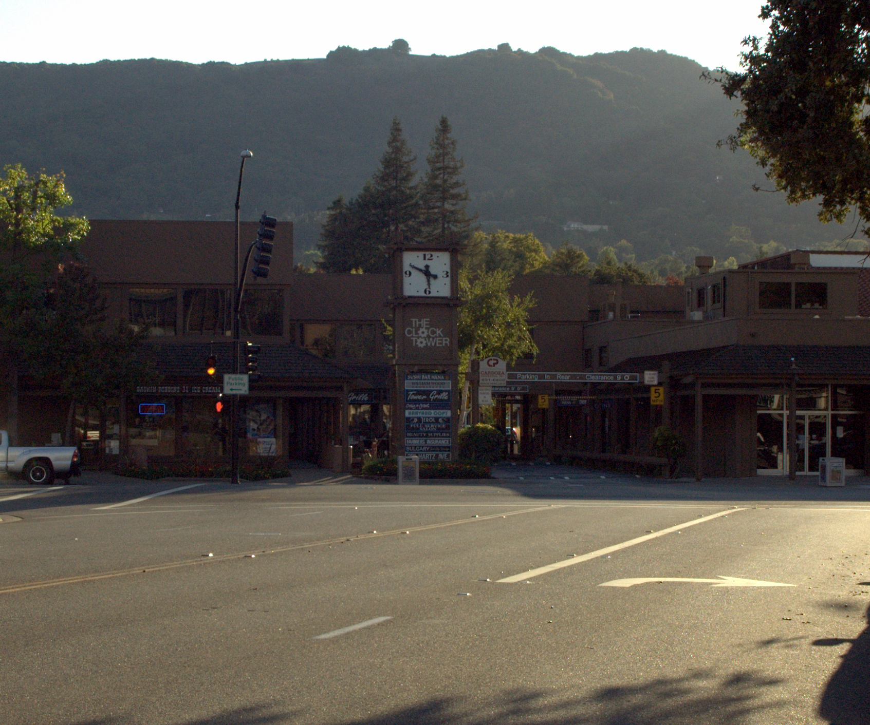
Danville is set in a narrow section of the San Ramon Valley with the Las Trampas Ridge to the west and the Diablo Range to the east. The most prominent landmark of Danville is the backdrop of Mount Diablo, which stands to the east at 3,849 feet (1,173 m) and provides a picturesque backdrop for Danville and neighboring towns and cities. Sycamore Creek drains some of the Mount Diablo slopes and flows through Danville.
Demographics[]
| Historical populations | |||
|---|---|---|---|
| Census | Pop. | %± | |
| 1960 | 3,585 | ||
| 1970 | 14,059 | 292.2% | |
| 1980 | 26,446 | 88.1% | |
| 1990 | 31,306 | 18.4% | |
| 2000 | 41,715 | 33.2% | |
| 2010 | 42,039 | 0.8% | |
| source:[11][12] | |||
2010[]
The 2010 United States Census[13] reported that Danville had a population of 42,039. The population density was 2,331.9 people per square mile (900.3/km²). The racial makeup of Danville was 34,942 (83.1%) White, 372 (0.9%) African American, 67 (0.2%) Native American, 4,417 (10.5%) Asian, 68 (0.2%) Pacific Islander, 509 (1.2%) from other races, and 1,664 (4.0%) from two or more races. Hispanic or Latino of any race were 2,879 persons (6.8%).
The Census reported that 41,796 people (99.4% of the population) lived in households, 56 (0.1%) lived in non-institutionalized group quarters, and 187 (0.4%) were institutionalized.
There were 15,420 households, out of which 6,034 (39.1%) had children under the age of 18 living in them, 10,389 (67.4%) were opposite-sex married couples living together, 1,140 (7.4%) had a female householder with no husband present, 449 (2.9%) had a male householder with no wife present. There were 452 (2.9%) unmarried opposite-sex partnerships, and 84 (0.5%) same-sex married couples or partnerships. 2,801 households (18.2%) were made up of individuals and 1,365 (8.9%) had someone living alone who was 65 years of age or older. The average household size was 2.71. There were 11,978 families (77.7% of all households); the average family size was 3.10.
The population was spread out with 11,196 people (26.6%) under the age of 18, 2,117 people (5.0%) aged 18 to 24, 8,050 people (19.1%) aged 25 to 44, 14,628 people (34.8%) aged 45 to 64, and 6,048 people (14.4%) who were 65 years of age or older. The median age was 44.5 years. For every 100 females there were 93.5 males. For every 100 females age 18 and over, there were 90.3 males.
There were 15,934 housing units at an average density of 883.8 per square mile (341.3/km²), of which 13,020 (84.4%) were owner-occupied, and 2,400 (15.6%) were occupied by renters. The homeowner vacancy rate was 0.8%; the rental vacancy rate was 5.3%. 36,137 people (86.0% of the population) lived in owner-occupied housing units and 5,659 people (13.5%) lived in rental housing units.
2000[]
As of the census[14] of 2000, there were 41,715 people, 14,816 households, and 11,867 families residing in the town. The population density was 2,305.6 people per square mile (890.3/km²). There were 15,130 housing units at an average density of 836.2 per square mile (322.9/km²). The racial makeup of the town was 86.30% White, 0.92% Black or African American, 0.21% Native American, 9.00% Asian, 0.12% Pacific Islander, 0.91% from other races, and 2.55% from two or more races. 4.66% of the population were Hispanic or Latino of any race.
There were 14,816 households out of which 42.2% had children under the age of 18 living with them, 70.7% were married heterosexual couples living together, 7.1% had a female householder with no husband present, and 19.9% were non-families. 15.5% of all households were made up of individuals and 5.6% had someone living alone who was 65 years of age or older. The average household size was 2.78 and the average family size was 3.13.
In the town the population was spread out with 28.6% under the age of 18, 4.2% from 18 to 24, 27.7% from 25 to 44, 29.3% from 45 to 64, and 10.3% who were 65 years of age or older. The median age was 40 years. For every 100 females there were 94.1 males. For every 100 females age 18 and over, there were 90.6 males.
The median income for a household in the city was $129,515, and the median income for a family was $148,013.[15] Males had a median income of $120,203 versus $75,706 for females. The per capita income for the city was $62,537. About 2.4% of families and 3.6% of the population were below the poverty line, including 3.5% of those under age 18 and 4.3% of those age 65 or over. The town ranked number one in the nation in a recent forecast done by Pinpoint Demographics for the highest per capita spending on clothing. The towns citizens are forecast to spend more than $2,000 per capita on clothing. [16]
Seasonal events[]
Spring:
- Devil Mountain 5K/10K run
- The Danville International Children's Film Festival, which has featured guests like Alyson Stoner, Joey Travolta, and Daryl Sabara.
Summer:
- The Fourth of July parade is popular, often drawing as many as 10,000 people, as reflecting its former small town values and always draws the local and regional incumbent politicians, including usually the Eleventh Congressional District representative.
- Hot Summer Nights held every-other Thursday on Hartz Avenue in Downtown Danville in July and August features hundreds of vintage pre-1960s automobiles on display with live music.
Fall:
- The Fall Arts Festival in late October draws craftspeople and artists with their works of highest quality.
Winter:
- Annual Christmas Tree lighting
Notable residents[]
- Richard Nelson Bolles Author of What Color is Your Parachute?, honored by the Library of Congress as one of the 25 books that have most changed American people's lives.
- Kevin Woo (Woo Sung Hyun) A member of South Korean pop group U-KISS.
- Chesley B. "Sully" Sullenberger — Pilot of US Airways Flight 1549, who made an emergency water landing in the Hudson River and is credited with saving the lives of all 155 crew and passengers.[17][18][19]
- Leroy Chiao[20] — Astronaut
- Sara Jane Moore — Attempted to assassinate President Ford [21]
- Jason Lucash — Inventor and Founder of Origaudio, Time Magazine's Top 50 Inventions of 2009, and winner on ABC's show Shark Tank (TV_series) [22]
- Bob Geren; former manager of the Oakland Athletics[23]
- E-40 (Earl Stevens) - Bay Area rapper
- Christy Turlington fashion model
- Greg Sestero actor
- Billy Beane General Manager for the Oakland Athletics
- Holzfeuer — Lead vocalist and founder of rock band ArnoCorps
- Jeff Tedford current head football coach at the University of California, Berkeley
- Bill Callahan (American football) former head coach for the Oakland Raiders and Nebraska Cornhuskers
- Chris Lieto Champion Ironman Triathlete.
- Chris Mullin former basketball player for the Golden State Warriors
- Duane Kuiper Comcast SportsNet broadcaster; former second baseman, Cleveland Indians, San Francisco Giants
- Terry McMillan author of How Stella Got Her Groove Back
- Matt Sosnick, the San Francisco-based sports agent profiled in Jerry Crasnick's License to Deal.
- Brent Jones 1987-98 49ers ALL-PRO Tight End, CBS Sports NFL Analyst 1998-2007, Managing Director Northgate Capital 2000-Current
- Nate Schierholtz outfielder, San Francisco Giants
- Randy Winn former outfielder, San Francisco Giants
- Amy Lynn Stanley Former sports anchor/reporter CBS Affiliate in Massachusetts
- Jaclyn J. Harwood Hairstylist and Entrepreneur
- Chris Wondolowski and Stephen Wondolowski, brothers and current Major League Soccer players
- Evan O'Dorney, winner of the 80th Scripps National Spelling Bee in 2007[24]
- Joe Morgan former Cincinnati Reds Second Baseman and ESPN Color Commentator
- David Dornsife, chairman of the Herrick Corporation, the largest steel fabricator on the West Coast. Also a long time philanthropist who donated over $200 Million to USC's school of Letters, Arts, and Sciences in 2011. His wife Dana is the current president of the Lazarex Cancer Foundation.
- Doris Eileen Dutton, Oldest person in Danville, she was 104 years old at her death in 2004
Economy[]
A cargo airline, Asia Pacific Airlines, is headquartered in Danville. However, it conducts no operations in Danville (Its main base of operations is Guam).[25]
Top employers[]
According to the Town's 2010 Comprehensive Annual Financial Report,[26] the top employers in the city are:
| # | Employer | # of Employees |
|---|---|---|
| 1 | Costco | 185 |
| 2 | Safeway | 131 |
| 3 | J. Rockcliff Realtors | 131 |
| 4 | Crow Canyon Country Club | 84 |
| 5 | Alain Pinel Realtors | 78 |
| 6 | Lunardi's Markets | 74 |
| 7 | People & Properties Sotheby's International Realty | 73 |
| 8 | Danville Rehabilitation | 70 |
| 9 | Prudential California Realty | 64 |
| 10 | Sunrise Senior Living | 59 |
Points of interest[]
Museums and historic sites[]

Museum Of The San Ramon Valley
- Eugene O'Neill National Historic Site - Tao House.
- Museum of the San Ramon Valley (located in the restored 1891 Southern Pacific depot)
Parks[]
- Mount Diablo State Park
- Las Trampas Regional Wilderness
- Front Street Park
- Baldwin School Park
- Danville South Park
- Diablo Vista Park
- Green Valley School Park
- Greenbrook School Park
- Montair School Park
- Oak Hill Park
- Osage Station Park
- Sycamore Valley Park
- Hap Magee Ranch Park
Education[]
Danville Schools are included in the San Ramon Valley Unified School District
- Baldwin (John) Elementary School
- Del Amigo High (Continuation)
- Diablo Vista Middle School
- Green Valley Elementary School
- Greenbrook Elementary School
- Los Cerros Middle School
- Montair Elementary School
- Monte Vista High School
- Sycamore Valley Elementary School
- Tassajara Hills Elementary School
- Vista Grande Elementary School
- Charlotte Wood Middle School
- San Ramon Valley High School
Private schools include:
- San Ramon Valley Christian Academy (Christian)
- St. Isidore's School (Roman Catholic)
- The Athenian School (non-denominational)
Public libraries[]
The Danville Library of the Contra Costa County Library is located in Danville.[27]
Neighboring communities[]

|
Rossmoor | Alamo, Diablo, Blackhawk | Blackhawk |
|
| Las Trampas Regional Wilderness | Blackhawk | |||
 Danville | ||||
| Las Trampas Regional Wilderness | San Ramon | San Ramon |
In popular culture[]
The Indian movie My Name is Khan is set in "Banville," a thinly veiled version of Danville. The protagonists move to Danville from San Francisco, but experience bias after the September 11 attacks.
In the movie "Mrs. Doubtfire", starring Robin Williams, the family goes out to dinner at Bridges, a restaurant in downtown Danville.
See also[]
References[]
- ^ "Town of Danville :: Town Council". http://www.ci.danville.ca.us/Council_and_Government/About_the_Council/. Retrieved 2010-12-23.
- ^ U.S. Census
- ^ "Danville Municipal Code 1-10.1". http://www.amlegal.com/nxt/gateway.dll/California/danville_ca/danvillecaliforniamunicipalcode?fn=altmain-nf.htm$f=templates$3.0$vid=amlegal:danville_ca. Retrieved 2007-12-07.
- ^ http://images.businessweek.com/slideshows/20111206/america-s-richest-zip-codes-2011/slides/11
- ^ "Danville Farmers' Market". Archived from the original on 2007-10-12. http://web.archive.org/web/20071012193849/http://pcfma.com/marketdetail.php?market_id=4. Retrieved 2007-12-03.
- ^ "The Village Theater". http://www.ci.danville.ca.us/default.asp?serviceID1=881&Frame=L1. Retrieved 2007-12-03.
- ^ http://www.ci.danville.ca.us/Enjoy_Danville/Historic_Danville/
- ^ "A Town is Born". http://www.ci.danville.ca.us/default.asp?serviceID1=504&Frame=L1. Retrieved 2007-12-03.
- ^ Durham, David L. (1998). California's Geographic Names: A Gazetteer of Historic and Modern Names of the State. Quill Driver Books. p. 622. ISBN 9781884995149.
- ^ http://www.ci.danville.ca.us/Planning/Development_Applications/Danville_Hotel/%20The%20Danville%20Hotel
- ^ "CENSUS OF POPULATION AND HOUSING (1790-2000)". U.S. Census Bureau. http://www.census.gov/prod/www/abs/decennial/index.html. Retrieved 2010-07-30.
- ^ Area reported as Alamo-Danville during the 1970 census, which recorded a population of 14,059. (The separate communities of Alamo and Danville were not returned separately by the census).
- ^ All data are derived from the United States Census Bureau reports from the 2010 United States Census, and are accessible on-line here. The data on unmarried partnerships and same-sex married couples are from the Census report DEC_10_SF1_PCT15. All other housing and population data are from Census report DEC_10_DP_DPDP1. Both reports are viewable online or downloadable in a zip file containing a comma-delimited data file. The area data, from which densities are calculated, are available on-line here. Percentage totals may not add to 100% due to rounding. The Census Bureau defines families as a household containing one or more people related to the householder by birth, opposite-sex marriage, or adoption. People living in group quarters are tabulated by the Census Bureau as neither owners nor renters. For further details, see the text files accompanying the data files containing the Census reports mentioned above.
- ^ "American FactFinder". United States Census Bureau. http://factfinder.census.gov. Retrieved 2008-01-31.
- ^ http://factfinder.census.gov/servlet/ACSSAFFFacts?_event=Search&geo_id=&_geoContext=&_street=&_county=danville&_cityTown=danville&_state=04000US06&_zip=&_lang=en&_sse=on&pctxt=fph&pgsl=010
- ^ http://www.pr.com/press-release/299317
- ^ "Conference Speakers". HRO 2007 International Conference, Deauville. High Reliability Organizations, 2007. May 29–31, 2007. http://hro-fires.com/hro2007/speakers.html. Retrieved 2009-01-16.
- ^ Riley, Duncan (2009-01-15). "A320 Pilot Chesley Sullenberger’s Other Jobs: Accident Investigator and Safety Lecturer". TheInquisitr. http://www.inquisitr.com/15441/a320-pilot-chesley-sullenbergers-other-jobs-accident-investigator-and-safety-lecturer/. Retrieved 2009-01-16.
- ^ Jennifer Maloney (2009-01-16). "Pilot's heroic journey started long ago". Newsday. http://www.newsday.com/iphone/ny-lipilo0116,0,2377318.story?track=rss. Retrieved 2009-01-16.
- ^ "Leroy Chiao Biography on NASA". http://www.jsc.nasa.gov/Bios/htmlbios/chiao.html. Retrieved 2007-12-03.
- ^ "Don't Blame It On Danville". http://www.diablomag.com/archives/view_story/175/. Retrieved 2007-12-03.
- ^ http://www.contracostatimes.com/news/ci_18017542?source=rss&nclick_check=1
- ^ http://oakland.athletics.mlb.com/team/coach_staff_bio.jsp?c_id=oak&coachorstaffid=114712
- ^ Coile, Zachary (1 June 2007). "Danville boy wins Scripps Spelling Bee". San Francisco Chronicle. http://www.sfgate.com/cgi-bin/article.cgi?f=/c/a/2007/06/01/SPELLINGBEE.TMP. Retrieved 05 Jan 2010.
- ^ " Contact Info." Asia Pacific Airlines. Retrieved on June 2, 2009.
- ^ Town of Danville CAFR
- ^ "Danville Library." Contra Costa County Library. Retrieved on April 1, 2010.
External links[]
| |||||||||||||||||||||||||
| ||||||||||||||||||||

| This page uses content from the English language Wikipedia. The original content was at Danville, California. The list of authors can be seen in the page history. As with this Familypedia wiki, the content of Wikipedia is available under the Creative Commons License. |